|
Rosamond, California USA
PHOTO
TOUR - PAGE ONE
... The Wide View
 |
 |
|
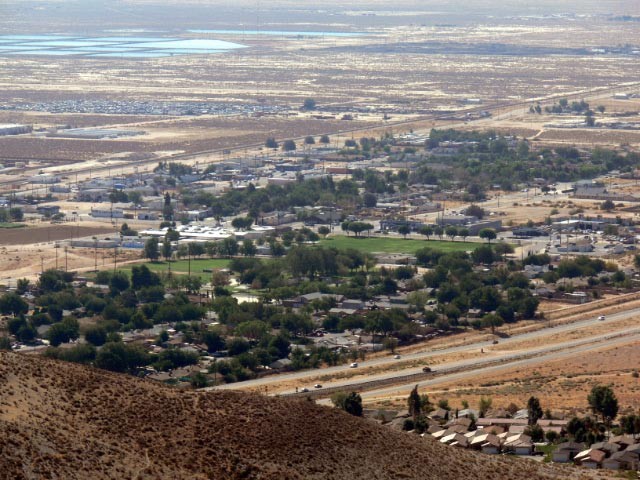
"Old Downtown" (looking SSE)
Bordered by the 14-Freeway in the foreground and to the
rear by Sierra Highway & its parallel railroad track, this picture
encompasses virtually the entire extent of the original town of Rosamond. |
Newer Housing (looking S.)
Turning to the right from the "downtown" view, this
picture starts to show a bit of the checkerboard of new housing developments
that are growing west of the freeway. Rosamond and virtually all the new
development is in Kern County; Los Angeles County starts a mile or so south
of the large housing tract just above center. |
About a mile east of Sierra Highway the
western edge of the huge Edwards AFB complex forms a barrier to possible
development. While this mile-wide strip is starting to fill in, the bulk
of development is happening west of the 14 (Antelope Valley) Freeway along
Rosamond Boulevard, filling what was formerly farm/ranch country. Much of
this area also has more favorable drainage, simplifying engineering for the tract
developers.
 |
 |
|
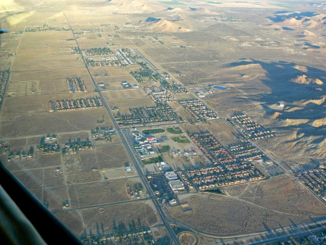
View West
From the 14 Freeway at the bottom of the picture you can see
the path of westward development. Most of the undeveloped land in this
picture already has zoning &
tract approval for new housing. Upper center is the runway and row of white hangar buildings of the
Rosamond Skypark, our town's civilian airport and a fly-in housing
development. A tract proposal for 4000 homes has been filed for the vacant
land N. of the Skypark. |
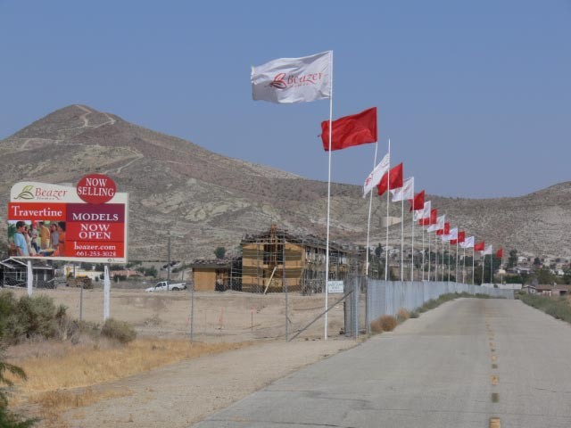
New Housing Starts
Even with the downturn in housing not yet over, the
demand for attractive yet affordable housing continues to support
development activity at a measured pace.
|

|